 The Broadside of a Yarn
, Inspace, Edinburgh, November 2012.
 The Broadside of a Yarn
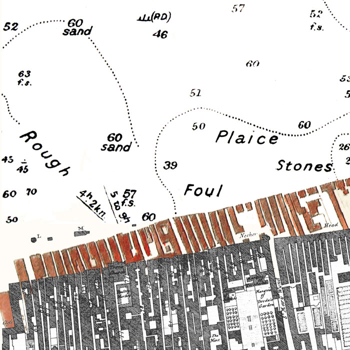
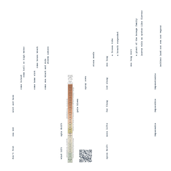
 is a multi-modal performative pervasive networked narrative attempt to chart fictional fragments of new and long-ago stories of near and far-away seas with nought but a QR code reader and an unbound atlas of hand-made maps of dubious accuracy. This project is, in a Situationist sense, a wilfully absurd endeavour. How can I, a displaced native of rural Nova Scotia (New Scotland), perform the navigation of a narrative route through urban Edinburgh (Old Scotland)? How can any inhabitant of dry land possibly understand the constantly shifting perspective of stories of the high seas?
The Broadside of a Yarn remediates the broadside, a form of networked narrative popular from 16th century onward. Broadsides were written on a wide range of topical subjects, cheaply printed on single sheets of paper (often with images), widely distributed, and posted and performed in public. During the
Remediating the Social exhibition,
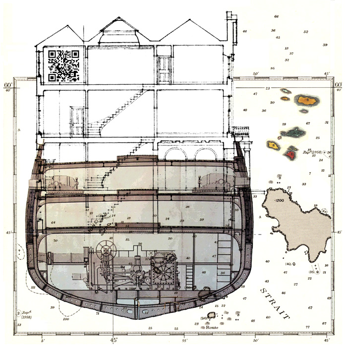
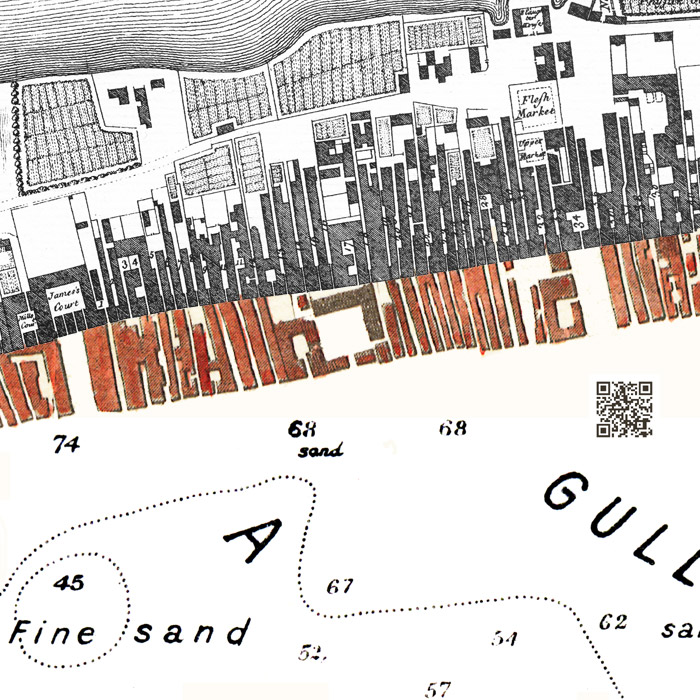
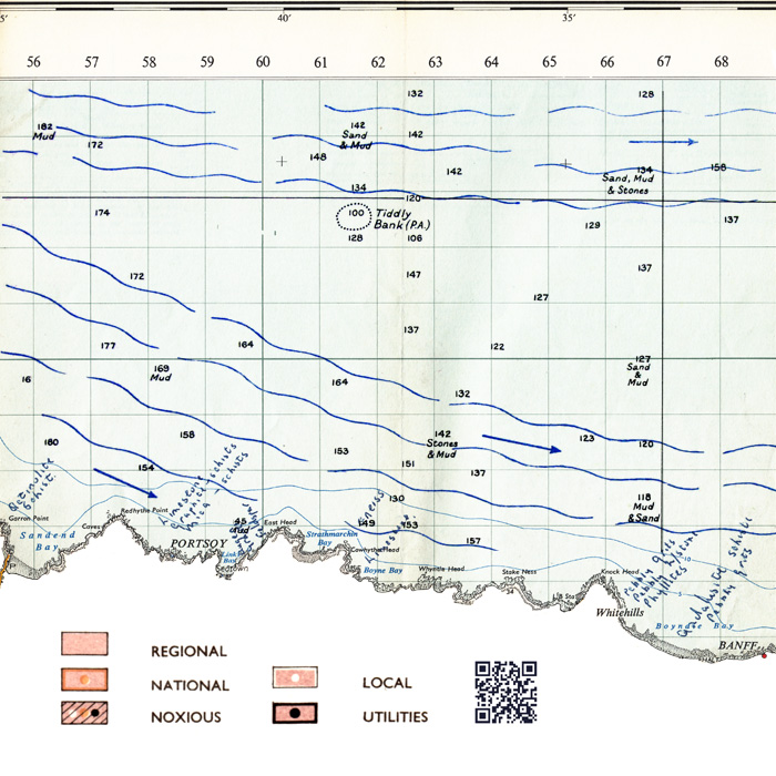
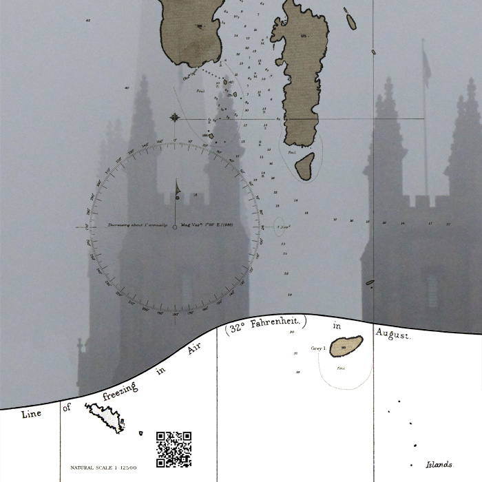
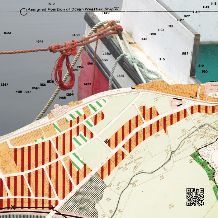
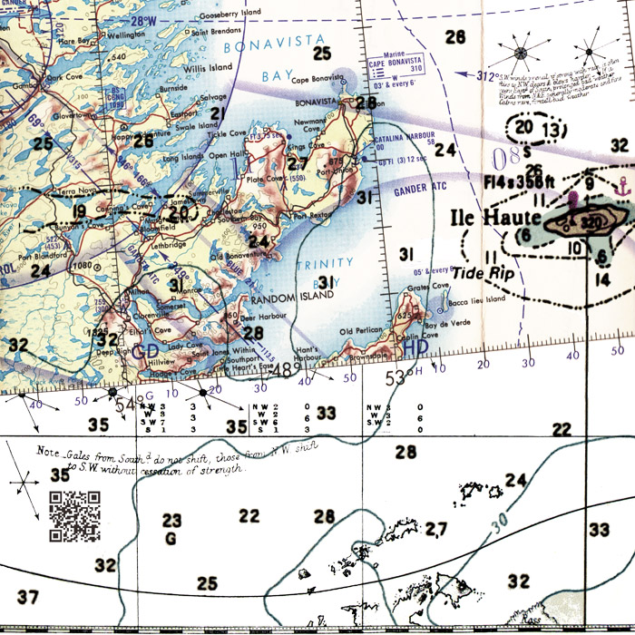
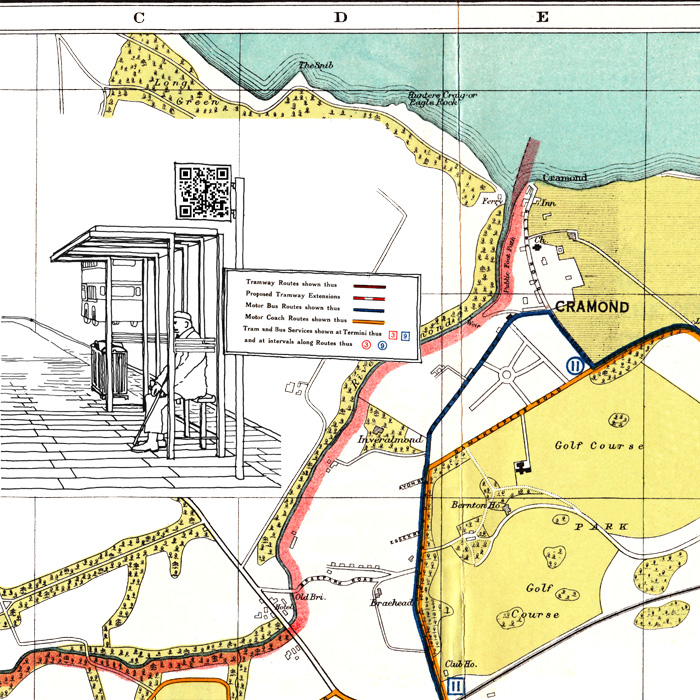
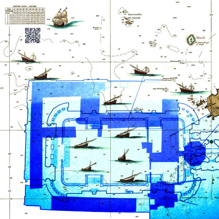
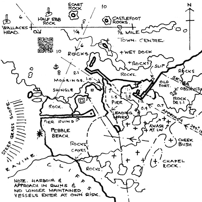
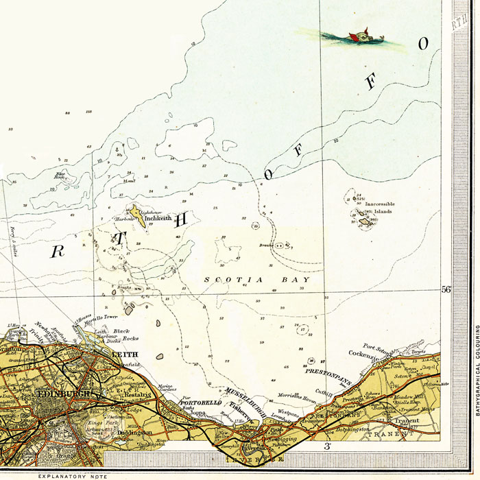
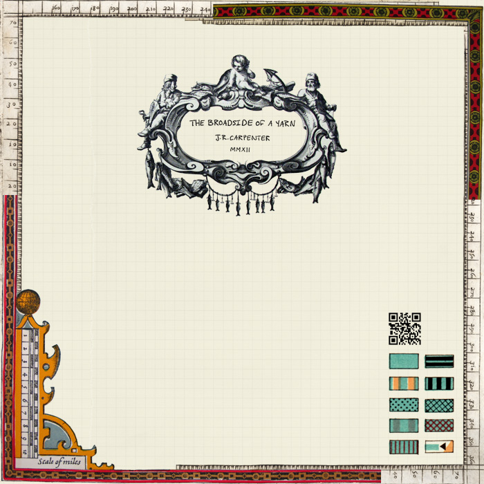
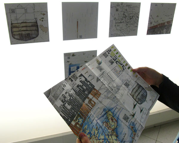
The Broadside of a Yarn was posted as a grid of A3-sized square maps at Inspace gallery, and freely distributed as broadside-sized sheet. The images to the right of this text are intended to offer a sense of the cartographic space of
The Broadside of a Yarn. They are representations of the work, not the work itself. (Click to enlarge)
The Print Map as a Ĺliterary platformĺ, The Literary Platform, 22 May 2013
The Broadside of a Yarn: A Situationist Strategy for Spinning Sea Stories Ashore, Performance Research: A Journal of the Performing Arts, 18:5, 88-95. Published online: 13 Mar 2014
Authoring Software entry on The Broadside of A Yarn
For more information about The Broadside of a Yarn, scroll right >>>.
Broadside Handout, Inspace, Edinburgh, November 2012.
The purpose of this map is not to guide but rather to propose imprecise and practically impossible routes of navigation through the city of Edinburgh, along the Frith of Forth, into the North Sea, into the North Atlantic, and beyond into territories literary and purely imaginary. Or it may suggest a journey of another kind, a pervasive performative wander through a sea of stories.
The Broadside of a Yarn conflates and confabulates characters, facts, and forms of poetic, narrative, cartographic and quasi-scientific accounts of fantastical islands, impossible pilots, and all manner of voyages into unknown streets, harbours, and seas undertaken over the past 2340 years or so. An incomplete list of references is offered to the right of this text >>>.
Like the printed broadside ballads of old, the public posting of
The Broadside of a Yarn signified that it was intended to be performed. Embedded within the highly visual cartographic space of this printed map are QR codes which link mobile devices to computer-generated narrative dialogues intended to serve as scripts for poly-vocal performances.
A poli-vocal performance based on
The Broadside of a Yarn was presented Thursday 1st November 20.00 in the Sculpture Court, Edinburgh College of Art.
Remediating the Social program.
A comprehensive overview of the Remediating the Social conference and exhibition has been posted on Electronic Literature Authoring Software by Judy Malloy:
ELMCIP Invites Scholars and Artists to Remediating the Social, Edinburgh, November 1-3, 2012
Download the
Remediating the Social exhibition catalogue.
THE BROADSIDE OF A BIBLIOGRAPHY
A Civic Survey & Plan for Edinburgh (1949)
Agricola, Tacitus (97-98)
Antarctic Ocean, Defence Mapping Agency Hydrographic / Topographic Centre, Washington, D.C. (1967)
Bartholomewĺs Pocket Plan of Edinburgh and Suburbs, Geographical Institute
Blackĺs Guide to Edinburgh and its Environs (1879)
Bleau Atlas of Scotland (1654)
City of Edinburgh Transport Map, Geographical Institute
Edinburgh Streetscape Manual, Lothian Regional Council (1995)
The Firth of Forth in Old Picture Postcards Volume 2 (1990)
Geography, Strabo (30 BCE)
On the Ocean, Pytheas (320 BCE - now lost)
Ordnance Survey Quarter-inch Map of Great Britain: Firth of Forth
The Owl and the Pussycat, Edward Lear (1871)
Pilot Handbook, Forth Yacht Clubs Association (1986)
National Library of Scotland
broadsides collection (1650-1910)
Natural History, Pliny the Elder (77)
Scottish Island Hopping: A guide for the Independent Traveller (1994)
The Secret Sharer, Joseph Conrad (1910)
The Tempest, William Shakespeare (1610ľ11)
The Uncanny, Sigmund Freud (1919)
Victorian Ordnance Survey Maps of Scotland: Edinburgh (1896)
Voyages and Discoveries, Richard Hakluyt (1589ľ1600)
Walks From City Bus Routes, Edinburgh City Transport
Wynken, Blynken, and Nod, Eugene Field (1889)
MANY THANKS
To
ELMCIP, for commissioning this work.
To Mark Daniels at
Inspace, Simon Biggs and Elizabeth Hodson at Edinburgh College of Art, and Donna Leishman and Steve Gibson for Edinburgh ground support.
To everyone who helped me find maps, charts, books, phamplets and other ephemera at
Old Town Bookshop,
National Library of Scotland and National Museums Scotland in Edinburgh, and at
The British Library and
The Bodleian Library maps Reading Rooms.
To
Totcom Copy Centre in Totnes and
Edinburgh Copy Shop in Edinburgh, for their great patience with artist's print projects.
To the performance writing programming consultation team: Caden Lovelace, Braille Fem, Amy McDeath, and Steve Booth.
To Barbara Bridger, secret sharer of dramaturgy.
And to Jerome Fletcher for everything else.
J. R. Carpenter 2012